Bus Route Coverage vs. Stop Spacing: What Makes a Useful Connection?
Bus route coverage vs. stop spacing shows whether a bus reaches your destination and how far you may walk to board, helping you compare real trip options.
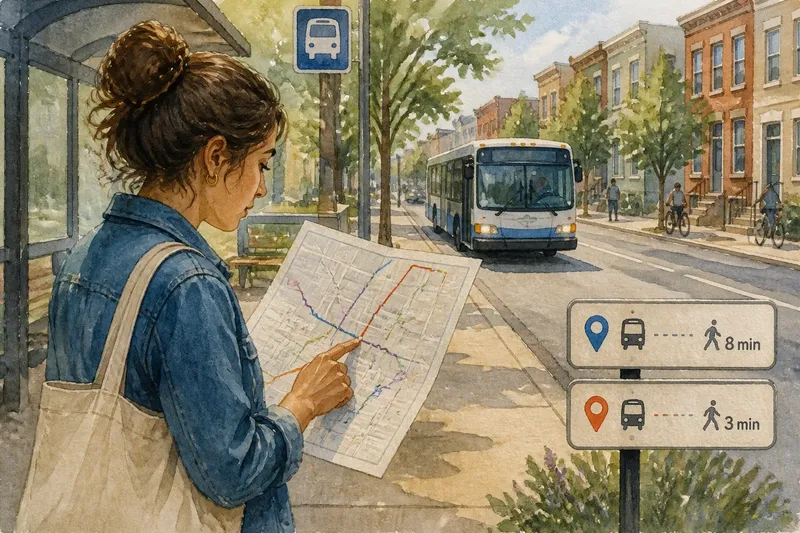
Bus route coverage vs. stop spacing can make a big difference when you plan an ordinary trip. A bus line may reach your destination, yet its nearest stop could leave you with a long walk.
What does bus route coverage tell you?
Route coverage describes the places a bus route connects. A route map can show whether service reaches a neighborhood, job center, school, clinic, or transfer point. It answers: does the network offer a path between the places I care about?
Coverage is more than a line on a map. Where a route starts and ends, which streets it follows, and how it connects with other routes all matter. A bus that reaches a neighborhood but stops short of a major destination may offer presence without a convenient trip.
Maps also simplify. A line near a destination does not show every detail of the walk to a stop, the route’s operating hours, or the transfers needed to finish a trip. Check the transit agency’s route map and schedule together, and use a journey planner such as Google Maps or the agency’s app for the trip you have in mind.
What does stop spacing tell you?
Stop spacing describes how far apart bus stops are along a route. Closely spaced stops mean riders encounter boarding points more often as they travel along that street. With wider spacing, there are longer stretches between stops.
This answers a different question from coverage: how far might I need to walk to reach a stop? The answer can matter when carrying groceries, traveling with a stroller, or managing a walk that feels difficult. What counts as a comfortable distance varies, so the map is a starting point, not a personal verdict.
Stop spacing is not service frequency. Service frequency describes how often buses run, often expressed through scheduled departure times or the interval between buses. A route can have closely spaced stops and infrequent buses, or wider stop spacing and frequent service. Use the map for stop locations and the schedule for bus arrival times.
Why can’t one measure stand in for the other?
Coverage and stop spacing describe separate parts of access. A route may reach many useful places while leaving long walks between stops. Another may have closely spaced stops along a short corridor but connect fewer destinations. Neither feature alone tells you whether a trip will work well.
Say you live near a route that runs past your neighborhood and continues to a medical center. The map shows that useful connection, but the closest stop is a long walk from home. A different route has a stop nearby but heads toward a shopping district instead. The first route offers the needed destination connection; the second offers easier access to a stop but not the same trip.
Describe both features plainly: “This route connects the neighborhood to the clinic, but its stops are widely spaced.” That says more than calling the route simply good or poor. It also distinguishes a missing destination connection from a difficult walk to existing service.
How can you compare routes for a real trip?
Start with your trip rather than the route’s appearance. Identify your starting point, destination, and the times you need to travel. Then check whether a route reaches both areas, where you would board and leave, and whether you need to transfer.
Imagine you need to travel from an apartment to a library. The route map shows a direct connection between the two neighborhoods, but the marked boarding stop is several blocks from home. A second route passes nearer to the apartment but requires a transfer. Compare the walking paths, scheduled service, and transfer location. The choice becomes clear as a tradeoff: a longer walk on a direct route or a shorter walk with a more involved journey.
- Destination: Check whether the route reaches the place you need. If it does, consider it as an option; if it stops nearby, check the remaining walk or another connection.
- Boarding point: Check the actual stop marker, not just the route line. If a usable stop is nearby, consider boarding there; if not, compare another stop or route.
- Walking path: Check the street map for a practical path from your origin to the stop. If the path works for you, keep the route in consideration; if it does not, look for another stop or a closer route.
- Service time: Check the schedule for the time you need to travel. If a bus is listed then, consider that departure; if not, check another route or travel time.
- Transfers: Check whether you must change buses and where. If the transfer fits your trip, compare it with a direct option; if it does not, look for a different connection.
- Return trip: Check the route and schedule in the opposite direction. If service fits your return time, keep the option; if not, plan another route or mode for the return.
Transit maps and schedules can change, and stop spacing may reflect local street conditions or service choices. For current details, use the transit agency’s map, timetable, and rider notices.
Which map details answer common questions?
Does a route passing my block mean I have a nearby stop?
Not necessarily. Check the marked stop locations, since a route line can run along a street without showing exactly where boarding is allowed.
Does a stop close to home mean the route goes where I need?
No. Follow the route in both directions and check its destinations and transfer points. A nearby stop helps only if the service connects to the rest of your trip.
Are closely spaced stops the same as frequent buses?
No. Stop spacing describes where boarding points sit along a route; service frequency describes how often buses run. Check the schedule or service interval to answer the second question.
Can a route map show whether a walk is manageable?
It can locate stops, but it may not capture every condition along the way. Check a street map or the transit agency’s accessibility information for details relevant to your route.
How should you describe what the map shows?
Use coverage language for destinations and stop-spacing language for access along the street. “The route reaches the community college” describes coverage. “Stops are far apart near the eastern end” describes stop spacing. If both matter, state both rather than folding them into one judgment.
Bus route coverage vs. stop spacing helps you read a map without confusing where a route goes with where you can board. For a specific trip, check destination coverage first, then stop locations and walking access, and finally the schedule for service frequency. That order keeps three separate questions visible when you choose a route.